There is a version of American history that gets told in textbooks — the grand sweep of manifest destiny, federal land surveys pushing westward, the mighty Mississippi serving as commerce's great spine. And then there is the version where a single farmer in central Illinois quietly pocketed toll money from steamboat operators for eleven years because the federal government lost a map.
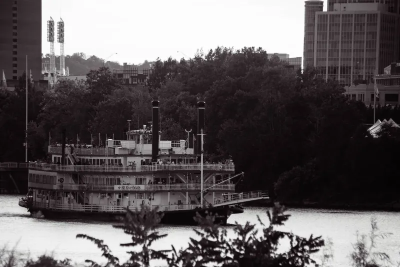
 Photo: Mississippi River, via s3.amazonaws.com
Both versions are true. Only one of them sounds like something a novelist made up after a long afternoon.
How You Accidentally Deed a River to Someone
The General Land Office, established in 1812, was responsible for surveying and recording federal land across an expanding nation. It was, to put it charitably, overwhelmed. By the 1840s, surveyors were working with crude instruments across thousands of miles of territory, filing hand-drawn plats that had to be transcribed, copied, and catalogued by clerks in Washington who were drowning in paperwork.
 Photo: General Land Office, via www.everythinglubbock.com
Somewhere in that flood of documents, a plat covering a section of bottomland along the Illinois side of the Mississippi went sideways. The survey line — which was supposed to trace the high-water bank of the river — was drawn several hundred yards too far east. On paper, this created a narrow but legally coherent strip of land that included not just the riverbank but a meaningful slice of the river itself, including the navigable channel that steamboats used daily.
That strip was subsequently entered into the federal land records and, through the normal process of frontier land sales, ended up in the hands of a farmer named Elias Cord sometime around 1847. Cord bought his property in good faith, paid his filing fees, and received a deed that — unbeknownst to anyone at the time — technically described a piece of one of the most trafficked waterways in North America.
The Moment Cord Realized What He Had
According to county court records from the period, Cord didn't discover the anomaly himself. A land attorney passing through the region noticed the discrepancy while reviewing neighboring property disputes and, in what must have been a genuinely remarkable conversation, explained to the farmer that his deed appeared to include the river channel.
Cord, by all accounts a practical man, asked a straightforward question: did that mean he could charge boats for using it?
The attorney, apparently, said it was worth trying.
Beginning around 1849, Cord began stationing a representative at a small dock near the affected channel and requesting payment from steamboat operators who passed through — framing it not as a shakedown but as a legitimate riparian toll, the same kind of fee that private ferry operators and mill owners collected under established property law. Rates were modest. Most captains, bewildered but uncertain of their legal footing, paid.
Two Trips to Court, Two Unexpected Outcomes
Not everyone paid quietly. Two steamboat companies challenged Cord's claim in Illinois circuit court during the 1850s, arguing that navigable rivers were by definition federal property and could not be privately owned under any deed, however mistakenly issued.
Cord's attorneys countered with a surprisingly durable argument: the federal government had issued the deed. The federal government had recorded it. If Washington wanted to void it, Washington needed to void it through proper legal channels — and until that happened, the deed was valid on its face. Illinois courts, wary of setting a precedent that could destabilize hundreds of other land grants issued under equally chaotic surveying conditions, declined to rule against Cord in either case. Both decisions were narrow, technical, and deeply unsatisfying, but they held.
For eleven years, the tolls kept coming.
Congress Finally Noticed — Barely
By the early 1860s, the absurdity had grown difficult to ignore. Steamboat traffic on the Mississippi was booming, the river was a critical artery for wartime supply chains, and the idea that a private citizen held a colorable legal claim to part of it was becoming genuinely inconvenient.
A corrective land act was introduced in Congress in 1861 to void the original plat error and formally restore the affected channel to federal jurisdiction. It should have been routine. Instead, it nearly died in committee — not because anyone supported Cord's claim, but because the legislation was initially drafted so broadly that it threatened to invalidate dozens of other land grants in the region, creating a political firestorm among Illinois landowners who had nothing to do with the river dispute.
A revised, narrower version eventually passed. Cord received a modest compensatory payment for the loss of his claim — the government, perhaps wisely, did not want to litigate what eleven years of collected tolls might be worth in a damages suit — and the matter was formally closed.
Why This Story Still Matters
Elias Cord never set out to own a river. He bought a piece of bottomland, discovered he'd accidentally been handed something extraordinary, and then did exactly what any reasonable person might do: he asked a lawyer if he could make money from it.
The deeper absurdity isn't that one man collected tolls from steamboats. It's that the system which enabled it — an overwhelmed land office, exhausted surveyors, clerks copying coordinates by hand into ledgers nobody would check for years — was the same system responsible for distributing millions of acres of American land. Cord's case was unusual only because someone noticed.
How many other errors didn't get caught? The General Land Office never said.